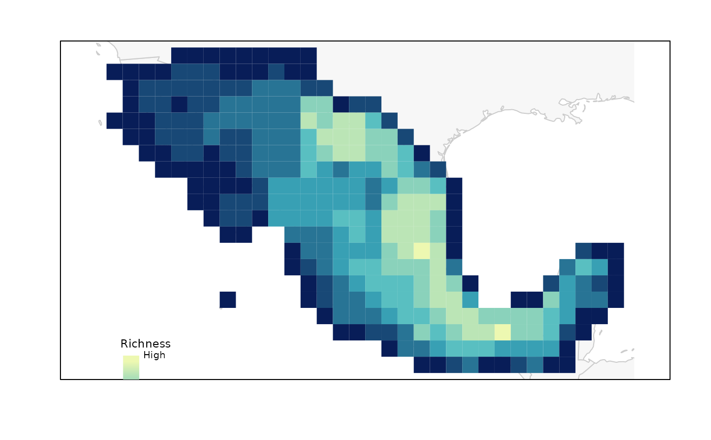
Plot of PAM indices in geography
Usage
plot_PAM_geo(PAM, index = "RI", master_selection = NULL,
             region_border = TRUE, mask_border = FALSE,
             selection_type = NULL, selection_number = 1,
             col_pal = NULL, border = NULL, col_sites = NULL,
             col_pre = NULL, pch_sites = 16, pch_pre = 16)
Arguments
- PAM
object of class base_PAM.
- index
(character) code for the index to be plotted. Options are: "RI" (Richness), "RIN" (Richness normalized), "DF" (Dispersion field), or "MCC" (Mean composition covariance). Default = "RI".
- master_selection
master_selection object derived from functions
random_selection,uniformG_selection,uniformE_selection, orEG_selection.- region_border
(logical) whether to add region border to the plot. Default = TRUE.
- mask_border
(logical) whether to add mask border to the plot. Ignored if mask is not present in
master_selection. Default = FALSE.- selection_type
(character) Type of selection depending on the function used to select sites. The options available are "random" (
random_selection), "G" (uniformG_selection), "E" (uniformE_selection), and "EG" (EG_selection).- selection_number
(numeric) number of selection to be plotted. Default = 1.
- col_pal
color palette function to be used in defining colors for the
indexto be plotted. The default, NULL, uses a simple color blind friendly palette similar to viridis,purplow. Warmer colors indicate higher values.- border
color for cell borders of the PAM grid. The default, NULL, does not plot any border.
- col_sites
color for selected sites. The default, NULL, uses a red color to represent selected sites.
- col_pre
color for preselected sites. The default, NULL, uses a purple color to represent preselected sites. Ignored if preselected sites are not present in
master_selection.- pch_sites
(numeric) integer specifying a symbol when plotting points of selected sites. Default = 16.
- pch_pre
(numeric) integer specifying a symbol when plotting points of preselected sites. Default = 16. Ignored if preselected sites are not present in
master_selection.
Value
A plot of index represented in geography. Selected sites are added if
master_selection is defined.
Examples
# Data
b_pam <- read_PAM(system.file("extdata/b_pam.rds",
                              package = "biosurvey"))

# Plotting
plot_PAM_geo(b_pam, index = "RI")

# You can add a legend with
legend_bar(position = "bottomleft", col = purplow(8), title = "Richness",
           labels = c("Low", "High"))
